
For teams working with underground utility records
See your utility maps in the real world.
Bring your utility maps into the real-world view. Compare them with field findings, update asset records as you work, understand the layout before digging and explain it to others.
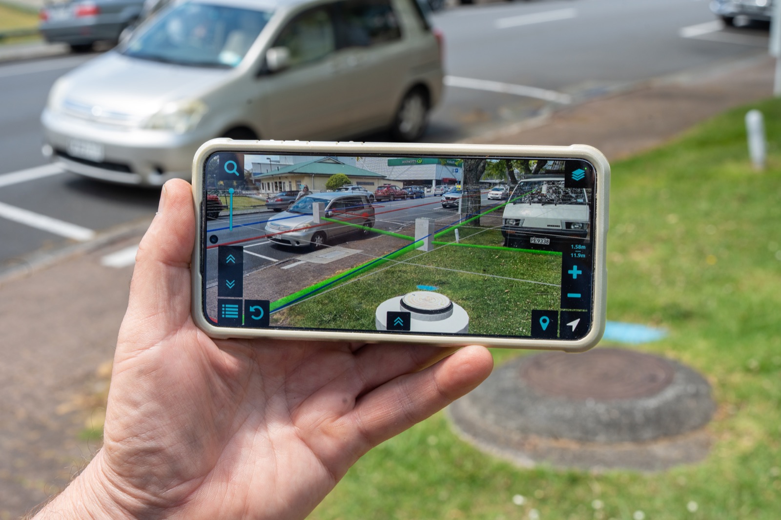
Turn complex plans into confident decisions.
Less time interpreting. More time on the job.
See recorded services against the actual site, so you can focus on planning the work instead of picturing it in your head.
Get ahead of costly surprises.
Compare records with field findings and flag discrepancies before the crew commits to the work.
Give your team and clients a shared view.
Walk your crew, colleagues or clients through the mapped layout and explain what you found, so you can discuss the work from a shared view.
How to use Augview
01
Free demo
See Augview in action with our demonstration data. Bring your questions and show us where it could help your team.
02
Link up your data
Bring your asset records and other authorised sources into one view. See the mapped layout on site and update your records as you work.
03
Put it to work
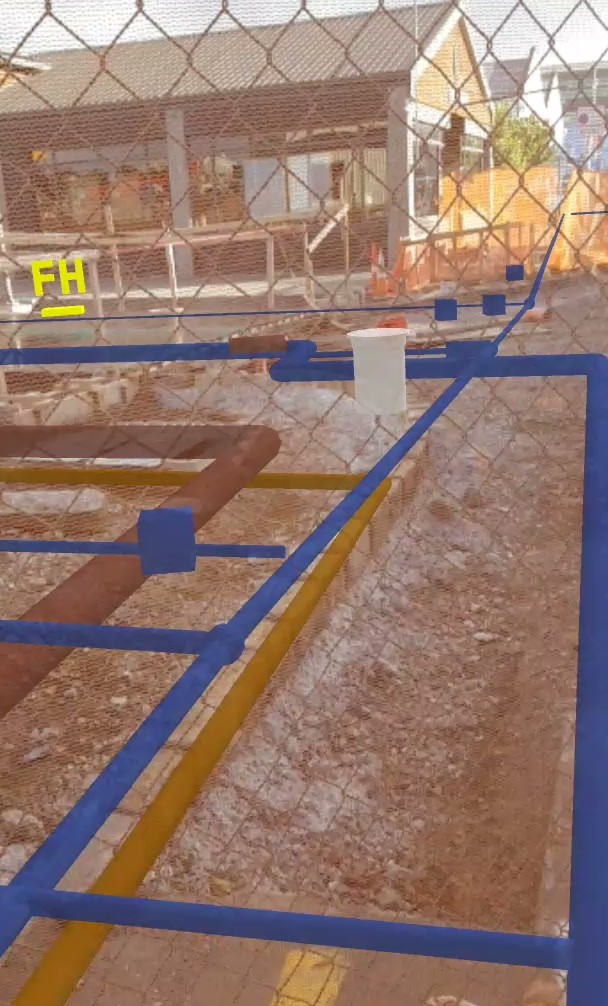
Plan in context
See the plan in its setting.
Walk the site with existing asset records in view to understand how they relate to the work you’re planning.
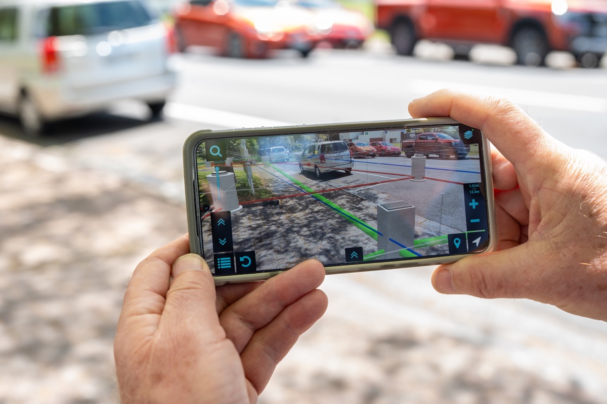
Locate & update
Put the map beside what you find.
Compare mapped services with your field findings, then update your records as you work.
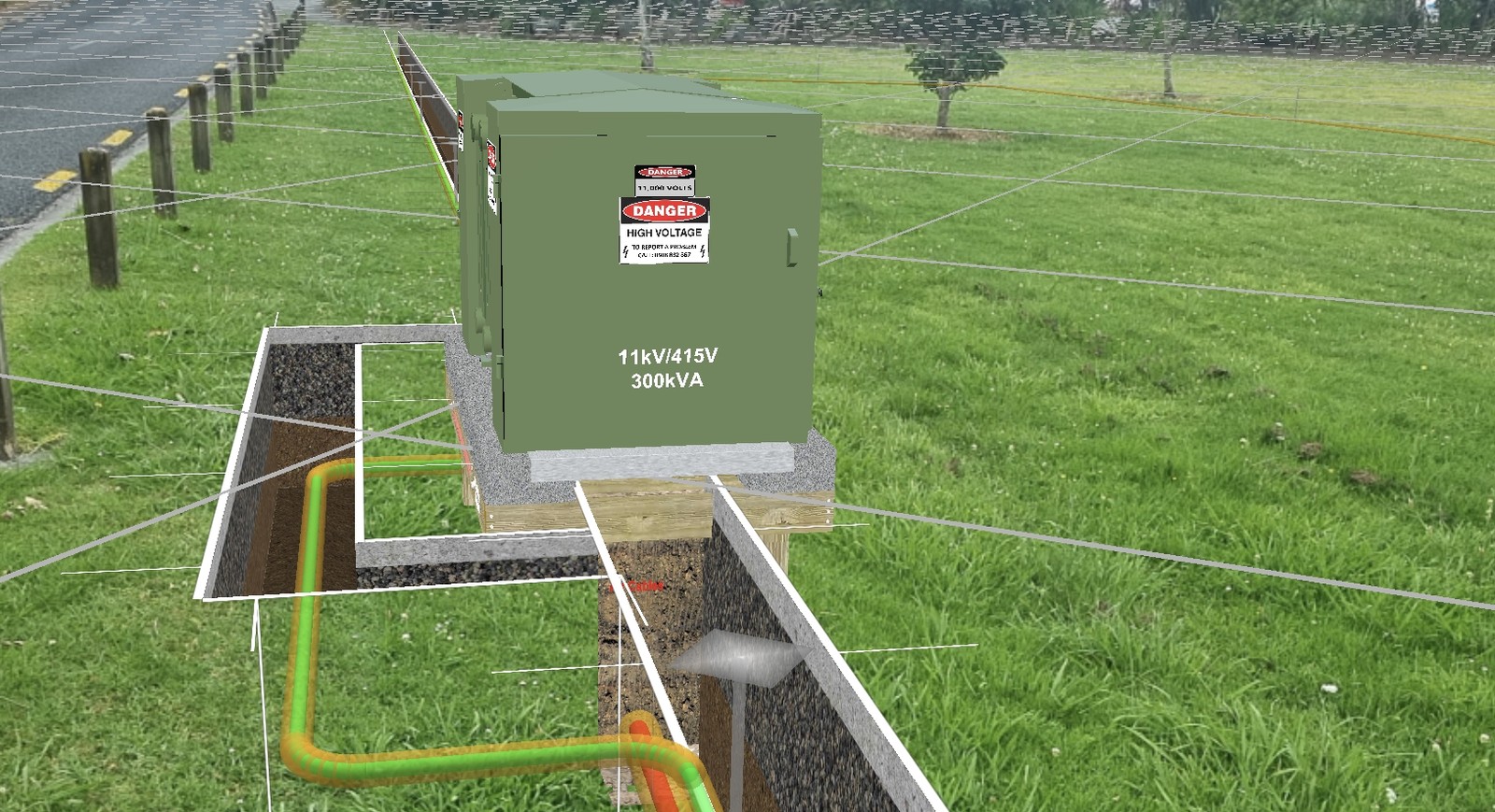
Before digging
See the mapped layout before work starts.
Help the crew understand the planned work and how recorded services relate to the work area.
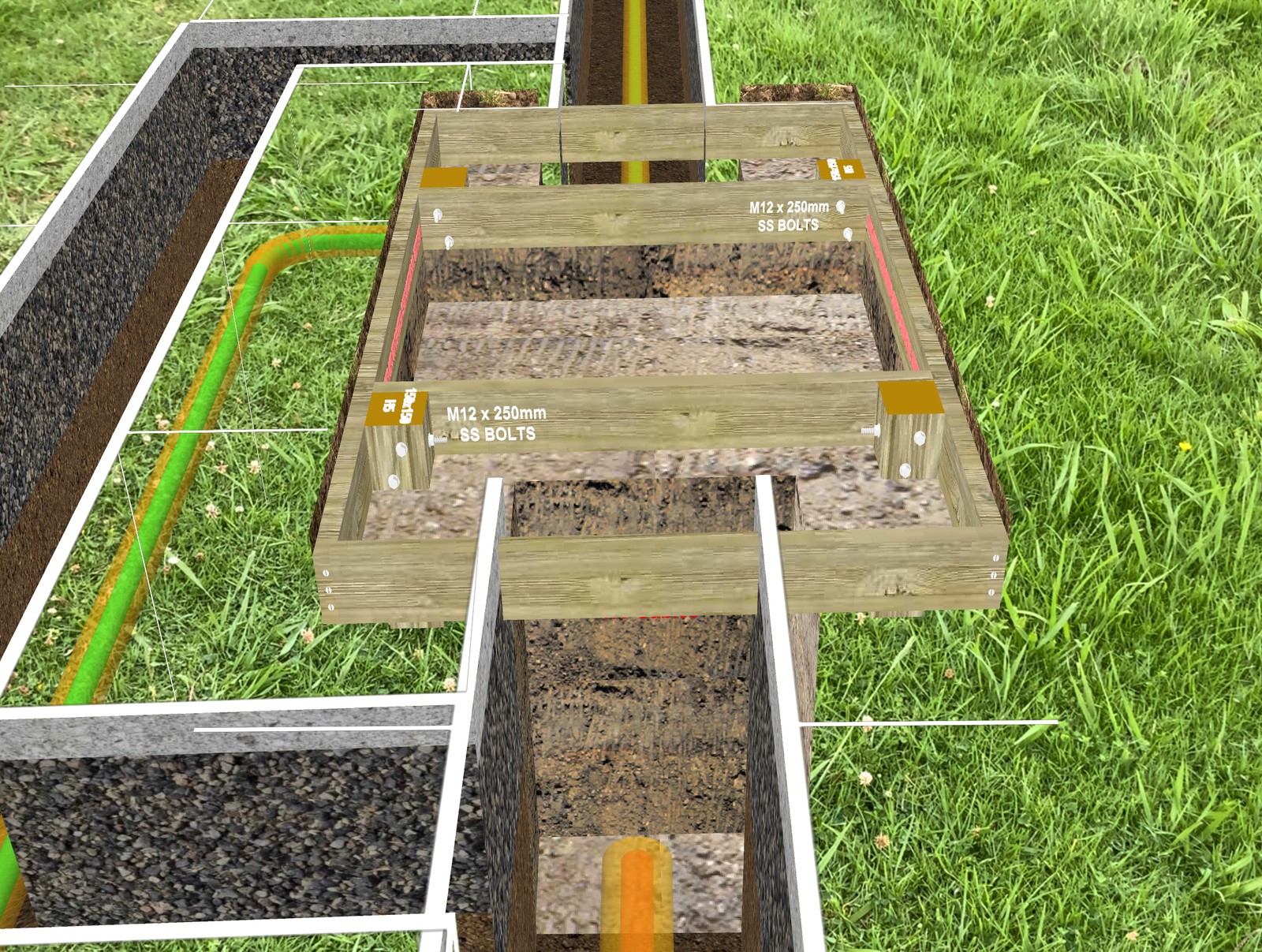
Check before backfill
Compare the plan with the work.
Compare the exposed installation with the design and resolve differences before backfilling.
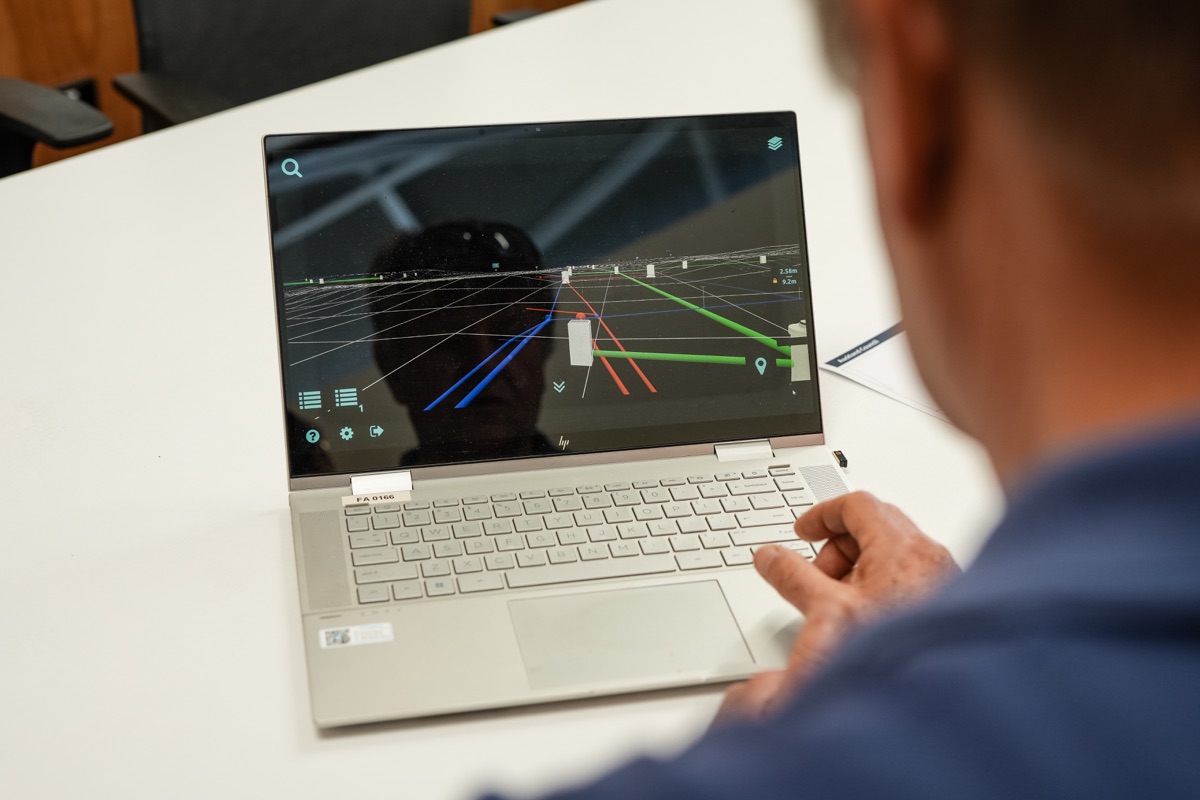
Explaining the layout
Help the next person see what you mean.
Show clients and colleagues the mapped layout in the setting of the job, so you can discuss it from a shared view.
Request a free demo
See Augview in action for free, then talk through how it could help your team.
Bring one task. We’ll start there.
Whether you’re comparing records on site, planning work or explaining a layout, tell us what you have in mind. No project files needed—just a chat about how Augview could help.
Standard licences: US$125 per device/month. The demo is free.Other pricing plans are available to suit your requirements.
Your details
Before we talk.
Still have a question? Email darcy@augview.net and we’ll help you work it out.
No. We’ll start with demonstration data so you can see Augview in action. Connecting your own authorised data is the next step.
Yes. You can view and edit asset information directly in the app, with permission to update the connected database. Make changes in the field and immediately see the updated records in the site view.
No. Bring together your own records, public data and other sources you’re authorised to use. Access and availability depend on each source and its owner, and we can help you get it set up.
We’ll help you find the right setup. Tell us what data and devices you use, and we’ll check compatibility and work through any configuration needed to get you going.
No. Augview shows mapped information; it doesn’t detect unknown utilities. It helps your crew understand the layout and spot differences worth checking, alongside your locating, verification and safe-excavation procedures.
If Augview fits your work, we’ll agree the data setup and next steps to get you up and running. For now, start with the free demo and we’ll take it from there.